
info@casitasdegila.com
|
575-535-4455 info@casitasdegila.com Southwestern Guesthouses on 265 Acres |
|
HOME :: THE 5 CASITAS :: RATES & POLICIES :: LOCATION :: NEWS :: THINGS TO DO :: ART GALLERY :: ABOUT US :: NATURE BLOG |
:: CHECK AVAILABILITY ::
Read about
Check Out
"I can't begin to tell you how much we enjoyed your casita. Although we didn't see too much animal wildlife, we saw indication of them in the form of tracks along the creek; the birds, though, were everywhere. The hike to Paradise Overlook—icing on the cake. We never even wandered out of your driveway. This is what a vacation should be ..."
"What a fabulous place you've made available to those of us who relish the finer things in life . . . views, trails, rocks, water, trees, birds, quiet, stars, horses, dogs, butterflies ... Life is Good at Casitas de Gila."
"What a beautiful little casita and a wonderful place to stay! I took the most gorgeous hike at sunset up the road trail [Paradise Overlook Trail] on the other side of the casita and watched the land glow from gold to orange to pink! I love the wildflowers and cottonwood scents as I walked through the little valley to get there. Definitely a piece of Heaven! ... I am in love with this place!"
"This place is so special and was a perfect way to end our trip to New Mexico. The casita and property are beautiful! So special to take an early morning hike on your trails. I saw so many inspiring sights! Watching the sunrise over the mountains is a perfect way to start the day ... Thank you so much for the beautiful retreat!"
"What a spectacular piece of property! ... We enjoyed the extensive trails, the stunning views from the summit of the Overlook Trail, the bewildering variety of minerals on the Dry Wash Trail, the peaceful walks along the creek, and the restful hammock. Watching the stars and listening to the owls from the hot tub after a day of hiking was really special. And the art gallery is really great! Thanks for everything." "... We like to hike. The trails invited us to a world of peace. The creek made a pleasant sound as the water gently flowed. The trees were magnificant. We loved sitting by the one where a table and chairs waited for us. The hammock was fun. Watching the moon come over the mountain and the stars was spectacular. Sometimes we would hear an animal cry out at night. Ten fabulous days that we will forever treasure." |
Hiking in Southwest New Mexico …
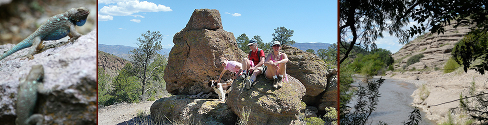
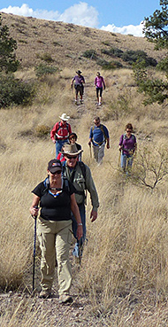
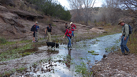
Guests interested in Hiking will find Hiking on Casita Lands . . . We have 265 acres of pristine high desert terrain that comprise the Casitas de Gila Bear Creek Nature Preserve. At present the Preserve is accessed by 15 different trails offering over 7 miles of hiking and walking through diverse, natural landscapes ranging in elevation from 4,700 feet to 5,500 feet. The trails vary from short, easy hikes right out the door of your Casita to longer, more difficult hikes into the hills and mountains beyond. Download our Trail Map for a look at our trails. Some of our trails require crossing Bear Creek, which will not be possible if the creek is running strong due to monsoon rains or winter/spring runoff.
Behind and immediately adjacent to the Casitas to the west are easy to moderately difficult trails winding across the juniper, pinon, mesquite, catclaw, and cactus covered flats and hills along the road leading into the Casitas. One easy trail, the Terrace-Hillside Trail, leads up to a nice picnic spot that overlooks Bear Creek Canyon, Turtle Rock, and the multi-colored lava flows and ash falls which make up the steep-walled escarpment of the Pinos Altos Range in the Gila Wilderness just five miles to the north. 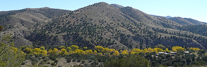
 Each Casita has a nature library with various books, guidebooks, and information about hiking in general and the major hiking trails in the area. When you are ready to venture away from the Casitas your hosts, Becky and Michael, with 20 years of hiking in the area, will be glad to suggest trails that will maximize your interests and experience. We also can provide detailed topographic maps for specific trails and nearby areas. Additional maps and information about selected trails in the Gila National Forest and Wilderness areas are on display in our Art Gallery courtyard; copies of these are available from the very friendly folks at the Glenwood Ranger Station a short distance from the Casitas and on the way to some of the best trails to be found in the Gila National Forest.
|
|
CASITAS DE GILA 575-535-4455 Michael & Becky O'Connor, Owners ©2023 Casitas de Gila, Inc. • Updated JANUARY 2023 |
|
|
— MEMBERS —
 One trail that is popular with all of our guests is our Self-Guided Nature Trail. This 0.6-mile loop trail winds its way across the side of the canyon just below the Casitas and then down to the Bear Creek floodplain before returning back to the Casitas. A detailed trail guide, provided in each Casita, will introduce you to the natural and cultural history of this special part of Southwest New Mexico by means of numbered markers at selected stops along the trail. In addition to identifying and providing interesting information about the plants, shrubs, trees, rocks, and rock formations encountered on the trail, the trail guide offers insight into the local geologic history, land forms and topography, and Native American and pioneer ranching heritage.
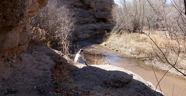
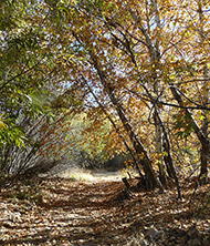
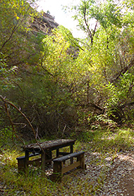
 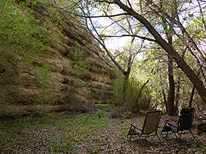 During the Winter of 2017-18, a new trail — the Cliffside Loop Trail — was developed for the Self-Guided Nature Trail. This trail opens up a unique, very special place along the Bear Creek floodplain on the east side of the creek where towering cottonwoods and sycamores soar skyward from a small clearing nestled between the gurgling waters of Bear Creek on the west and the 130-foot vertical cliffs of Gila Conglomerate on the east. Several sections of a huge cottonwood log have been placed for sitting, and there's a picnic table with benches and two comfortable reclining chairs along the trail. It's an ideal spot for birding and wildlife enthusiasts, for those seeking Nature's solitude, for enjoying lunch within a natural atrium, for undisturbed reading, drawing, or painting, or simply for tranquil meditation. Here, a quiet place awaits, where the only sounds are those of leaves rustling overhead, the murmur of the Creek, and the joyful chatter of birds as their sounds filter down on the golden shafts of sunlight that stream through the leaves high above.
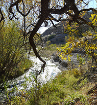
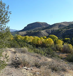
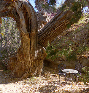 Several other trails are designed to highlight other fascinating aspects of the Bear Creek Riparian Area that extends for 3/4-mile through the middle of the Casita lands. Over the millennia this unassuming little creek, which normally babbles along quietly year-round about 100-feet below the Casitas, has cut deeply into this desert upland, following an ancient fault line to produce a spectacular cliff-lined canyon, heavily vegetated with groves of Cottonwood, Sycamore, Willow, Walnut, Ash, and Gray Oak. Several of the cottonwood and sycamore are very large and ancient, measuring up to 27 feet in girth and several hundreds of years in age.
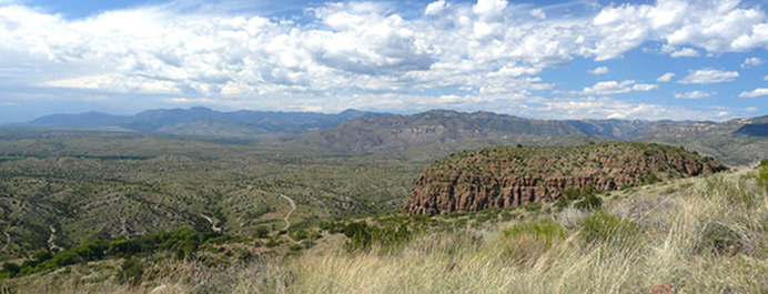
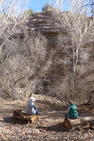
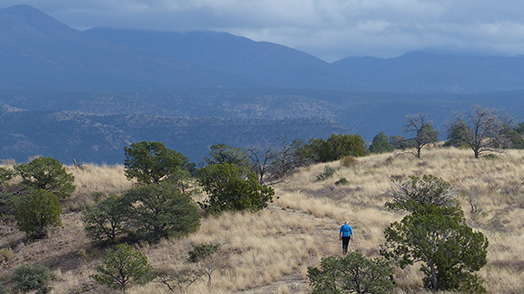
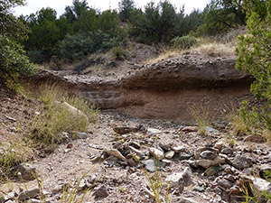 Across and beyond the creek, challenging and steeper trails await the more adventurous hiker. One interesting trail, the Dry Wash Trail, a favorite with rock and mineral collectors, leads up a dry wash side canyon from Bear Creek that is lined with colorful cliffs of Gila Conglomerate. Another trail, strictly for the physically fit, the Paradise Overlook Trail, climbs abruptly some 800 feet in elevation from Bear Creek over about a mile to provide an eagle’s eye view of the whole Gila Valley, the Pinos Altos and Mogollon mountains, the Gila Wilderness, the Blue Mountain Wilderness, the Burro Mountains, and beyond into Arizona.
 Caps, hand-carved walking sticks, and books and maps detailing hikes and hiking in the area, are available for purchase in our Art Gallery. Walkie-talkies are provided for guests who are walking alone on the Casita lands.